Posts for this topic...
-
Post your comments.... Sign In to Post
-
plotaroute admin Friday 22 Jul 2016 15:16:05
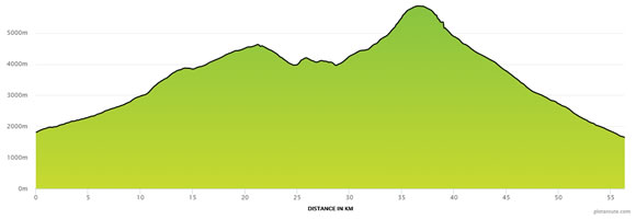
We are currently in the process of implementing some changes to our elevation profiles and statistics following feedback from some users that occasional fluctuations in elevation readings sometimes did not reflect real world conditions and were leading to inflated total ascent calculations. To alleviate this problem we have decided to increase the default distance interval we use between elevation readings, which should help to smooth out superficial bumps and dips that don't have a material effect on the overall profile of the route.
When you save a new route, we will now generate elevation readings at 90m intervals along the route (previously 30m) up to a maximum of 5000 readings per route, when the interval will be increased accordingly. You can still view a provisional elevation profile as you are plotting a route, but this is based on a maximum of 500 readings until the route is saved, when the more detailed version is generated, along with the complete set of elevation statistics for the route.
As part of these changes we have also added a new Total Descent figure to the elevation statistics available for each route. This was another request from our Feature Requests list.
The changes have already been implemented for any new routes you save and we will be recalculating the elevation statistics for all existing routes as soon as possible, so that elevation statistics for different routes can be compared on a like for like basis. Over 200,000 routes have now been saved on plotaroute.com, so these recalculations will happen over time, although we expect this to be completed within the next 7 days.
Hopefully these changes will also make it easier to compare ascent calculations from plotaroute.com with ascent calculations from other devices and applications, although please bear in mind that ascent calculations will always vary depending on the distance between sampled elevation readings and that ascent calculations by GPS devices can often be affected by altitude measurement inaccuracies and gaps in recordings due to a weak or lost GPS signal.
-
Nisse Son Monday 25 Jul 2016 17:29:00
Being one of the ones giving feedback on this topic I'm very happy to see you make an effort on imprioving this. Kudos to you! :-)
-
Glenn Czulada Thursday 28 Jul 2016 02:29:07
I just started using PAR a few weeks ago. Very good program and much better than MapMyRide which I have used the past 4 yrs.
I noticed right away that the elevations seemed inflated (anywhere from 20-30%). Introducing smoothing is a good idea because as stated in a previous ascent calc thread, small rises don't affect the ride much and a rider is looking for "real" elevation increases. It's best to find a way to have calculation results that are similar to other programs like Strava, MMR etc.
-
plotaroute admin Tuesday 02 Aug 2016 11:57:25
Thanks for your feedback Glenn - glad you're finding plotaroute easy to use.
John
-
Peter Robinson Friday 05 Aug 2016 10:26:33
That will be a great improvement to an already brilliant tool. I have experienced the inflated elevation figures on Plotaroute, but on other programmes too. This will remove some of the anxiety when you plan a a tour in a hilly area and it looks extremely tough and then turns out not to be so bad! I think the problem can sometimes be that the elevation model is not perfectly aligned with the road or not as detailed. I had an extreme case where the road ran along the bottom of a cliff in a river valley and was actually gently downhill but the elevation profile (not in Plotaroute) looked very steeply jagged.
-
John Taylor Sunday 04 Sep 2016 17:57:23
So am i right in thinking that if i am walking across a narrow steep ravine, say 50mtrs deep and only 30mtrs across it may miss this ascent / descent altogether?. We do a lot of wild moor walking and come across this situation regulary, so a regular check sounds the more accurate for for us, maybe not for cycling. Or am I assuming incorrectly.
Still a great app though. Thanks..
-
plotaroute admin Monday 05 Sep 2016 09:32:29
Yes, it's possible that short distance inclines and descents may not be counted depending on where the elevation samples are along the route, but it's worth bearing in mind that no source of elevation data is 100% accurate. Also, ascent figures will vary a lot between devices and applications due to different sampling intervals.
John
-
Kevin Bessett Thursday 27 Apr 2017 00:41:46
I'm a little late to the topic..I just discovered PAR via a post in a Garmin forum. I used it today for the first time and it left an excelent impression. I like the UI and how it's layed out, and like how many of the features operate. RWGPS has been my mapping tool, but PAR was about to become #1...
...but then saw the route I ploted had a total ascent of 1,889 feet! My eyes nearly poped out because it's no where near that. RWGPS shows 886 ft and my barimetric pressure altimiter is in that general range. And I know now that others report the same issue with PAR.
Having accurate ascount counts is a must, especially when planning out rides in areas not familiar to me.
Kudos to developers. PAR is a great tool except for the ascent calculation. Is this issue going to be fixed? I hope so because I want to use it!
-
plotaroute admin Thursday 27 Apr 2017 07:33:15
Hi Kevin,
The difference between elevation calculations from different applications is largely due to differences in the intervals at which elevation readings are taken. Less frequent readings will effectively iron out lumps and bumps making the total ascent figure much lower. This is particularly noticeable on relatively flat routes, like the one you've mapped. I believe that some applications also ignore small changes in altitude when calculating the total ascent, effectively resulting in further smoothing. For these reasons, ascent figures from different applications are never comparable and no one application has the "correct" result (even barometric GPS devices which can suffer from signal loss creating gaps in readings) - they are just different ways of interpreting the data.
Our approach is to sample elevation readings relatively frequently and then provide a Route Profile tool, which you can use to see how reduced sampling intervals affect the stats. If you look at your route in the route profile tool and adjust the Elevation Interval slider on the right of the chart, you'll see the total ascent drop dramatically.
We've looked into this issue quite extensively and at the moment I'm afraid we have no plans to make further changes to the way we calculate ascent figures. However, if you are able to obtain the calculation formuale for the other applications you are using, I'd be happy to do some more work on this to examine the differences.
John
-
Peter Marshall Thursday 28 Aug 2025 01:49:40
Is there a way to make the interval reading smaller (like the previous 30m) as opposed to 90m? I can't find a way just to generate more readings if desired for a route I make. Just for more information, I am trying to get a detailed elevation profile for a small segment (0.25 to 1mile).
