How To Help Improve OpenStreetMap (OSM) Maps
ADVERTISEMENT
More How-To Guides
- How to make a route private or public
- How to navigate a route using the plotaroute app
- How to estimate the time to complete a route
- How to share private routes with only selected people
- How to add photos to your routes
- How to show gradients on a route map
- How to change the default colour of your routes
- How to delete a route
- How to sync your routes to Garmin
- How to link Plotaroute with Epic Ride Weather
Watch Our Video Tutorials
VIEW TUTORIALS
Join In Our Forums
VIEW FORUMS
OpenStreetMap (OSM) provides map data for thousands of web sites, mobile apps and hardware devices, including plotaroute.com. It is built by a community of people who contribute and maintain data about roads, trails, cafés, railway stations and much more, all over the world. Anyone can contribute and it is easy to do so.
You can make changes to existing features on the map such as whether cycling is allowed on a road, or you can add new features, for example a new footpath that isn't currently shown. Any changes you make to OSM will normally appear visually on the OSM maps used by plotaroute.com maps within 7 days. It will take longer for changes to flow through to our routing engine, which is used to calculate routes and provide terrain data, as this is updated once a month.
The Surface and Allowed Access map attributes are two of the most important ones used by plotaroute.com, as these impact route calculations, so the following instructions explain how to update these, but there are various other attributes you can change.
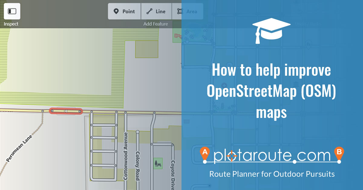
To make changes to OSM maps, follow these instructions:
- If you haven't already done so, you will first need to create a free account with OpenStreetMap (OSM).
- Sign in to your OpenStreetMap account.
- Click the EDIT button to launch the OSM Map Editor.

- Search for the approximate location of the road or path you want to update and select the correct location from the list:

- Zoom and drag the map the exact location of the map feature (road or path) you want to update.
- Move your mouse over the map feature - as you do so it will be highlighted with a brown background.

- Click on the map feature once it has been highlighted to select it. It will then be highlighted with a flashing red background. You can select other map features to edit in the same way.

- You'll now be able to review and change the attributes for the selected map feature in the panel to the left of the map.

- In the section headed "Surface", click the down arrow and select the the most appropriate option from the list.

- In the section headed "Allowed Access", choose which types are access are permitted.

- Repeat the process for any other changes you want to make. You can add new features to the map using the Point, Line and Area tools at the top of the map.
- Click the SAVE button to review your changes before submitting them.

- Enter a short description of the changes you made. If you're unsure about the changes and would like someone to review them you can select this option, although this may delay the changes appearing on plotaroute.com.

- Click the "Upload" button to submit your changes.
DESKTOP TABLET MOBILE
